|
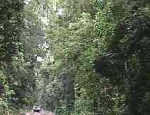
Danbulla State Forest Drive

- The Danbulla State Forest Drive is a circuit drive which begins near
Lake Barrine on
the Gillies Highway and ends at the Tinaroo Dam.
- Leaving The Chamber’s, the easiest
and most direct route to take is along the Gillies Highway, which takes you in a
north-easterly direction past Lake Barrine.
- The entrance to The Danbulla State Forest
Drive is well signposted and begins only a few kilometres past the Lake Barrine
turnoff.
-
Along the 30 km drive there are a number of points of interest including; the Cathedral Fig
Tree, Mobo Creek Crater, Lake Euramoo Arbour Walk and the
Kauri Creek Walk.
- The most
spectacular part of the drive is the initial part, or the North-Eastern section, where the
area has rainforests, eucalypt forests and pine plantations.
Cathedral Fig Tree:
- The Cathedral Fig Tree is located about 5 km from the Gillies Highway.
- It is the same
species of tree as the Cathedral Fig Tree (Ficus virens), but through different
growing pressure has evolved to display a different habit of the commonly called strangler
fig.
- Many species of animal can be seen seeking shelter in and around the Cathedral Fig
Tree including: Papuan Frog Mouth, Rose-crowned Fruit Dove, Emerald Fruit Dove,
Pale-yellow and Grey-headed Robin, Orange-footed
Scrubfowl, many species of reptile,
Possums and Tree Kangaroo.
Mobo Creek Crater:
- Mobo Creek Crater is located another few kilometres on from the Cathedral Fig
Tree.
-
There is a 600-metre rainforest-walking track with information signs, which will enlighten
you to the mysterious geological history of the crater.
- Geologists and scientists alike have not quite clarified the geological history of this
site.
- Part of the mystery could be caused by the flowing of Mobo Creek through the crater
which could have confused the geological sequence through the erosion properties of water.
-
It is an interesting attraction.
Lake Euramoo:
- The forest drive will then take you along to Lake
Euramoo.
- This lake is contained in a
double explosion volcanic crater.
- Being one of the youngest geological features in the
Atherton Tablelands, it is though to be a little older than ten thousand years old.
- Euramoo is quite a large lake, with a viewing platform looking out over the water and
its surrounding environment but there is no access to the water's edge.
- There is also an
interpretative sign giving you basic background information on the lake's history and
present features.
The Lake Euramoo Arbor Walk:
- Almost immediately beside the viewing platform of Lake Lake
Euramoo is the Arbor Walk.
- Allow
20 minutes to experience this arbor walk fully.
- A circuit walk guides you through the rainforest to where species of trees are
named. For example the Red Cedar, Tulip Oak, Rose Butternut, Northern Silky Oak,
and the Mahogany etc.
Kauri Creek Walk:
- This is one of the better walks of the area.
- It is a full circuit track of five and a
half kilometres.
- The first section of the walk takes you through the riverine vegetation
along Kauri Creek.
- The track climbs steeply for a section after leaving Kauri
Creek, then
descending quite steeply to return to the creek, taking you through to an old forestry
logging access road.
- This road is followed for most of the trip back to the car park and
picnic area.
- As the track leaves the road, it passes through a gathering of Brown
Salwood.
- These trees have regenerated in an area previously cleared for grazing.
- The track is designed for intermediate to advanced walkers, although for those who are
beginners, there is still the option to see the Red Cedar Tree located at a kilometre into
the track, before returning to the picnic area.
- Eager walkers are still recommended to
take the walk, as there are many places to stop and look at your surroundings whilst you
catch your breath.
- Be sure to wear shoes with a closed toe, preferably hiking boots, as there are many
roots which cross the path, some, difficult to see.
- The Kauri Creek walk will show some of the natural wonders of North Queensland, the
peace, serenity and beauty of the area should not be missed.
Tinaroo Lake and Dam:
- Tinaroo Lake is a huge man-made lake located to the north-east of Atherton.
- It is at
the end of the Danbulla State Forest Drive.
- The lake was formed in 1958 at the completion
of the Tinaroo Dam.
- The reservoir is used for activities such as irrigation and
hydro-electricity, yet, leisure activities such as fishing, swimming, water-skiing and
boating are allowed.
- Birdwatchers should find the area most rewarding, as the lake provides ideal conditions
for waterbirds.
- The lake attracts birds such as:
Great Crested and Australasian Grebe, Ibis, Egrets,
Spoonbills, Herons, Whistling-Ducks, Cormorants, Black Swan, Australian
Pelican, Duck species, Darter, Grey Teal, Rufous Night Heron, Hardhead,
Black-necked Stalk, Cotton and Green Pygmy-Goose, Dusky Moorhen, Purple
Swamphen, Eurasian Coot and the Caspian Tern.
- During the seasons of spring and summer, when the lake’s water level is low,
the muddy margins attract waders such as the:
White-bellied Sea Eagle, Osprey, Red-kneed Dotterel and
the Black fronted Plover.
|
